 Lake Garda Travel Guide
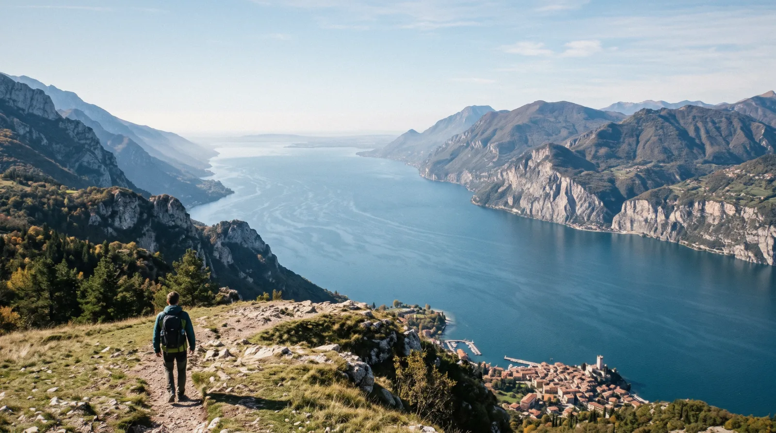
Lake Garda Map: Every Pin Coloured by How You Get There
This Lake Garda map carries 41 pins in five colours, and the colour tells you one thing only: how you get there. The lake runs 51.60 km north to south and is 17.20 km at its widest, spread over three regions. Start with the pins, then move to Lake Garda attractions or compare the Lake Garda towns. The shore-by-shore overview is on the home page (see what to see in Lake Garda).
Quick answer How the lake is laid out, and how to cross it
Lake Garda runs 51.60 km from the flat south to the narrow north tip, and the railway touches it only along the south shore, at Desenzano and Peschiera stations on the Milan-Venice line. The east shore belongs to Veneto, the west shore to Lombardy, and the north tip to Trentino. In season the boat is the way to cross between the two sides, and the timetable gives a practical ruler for the distances.
Key takeaways
- The boat is the ruler here. Desenzano to Sirmione takes 20 minutes by ordinary ferry, Peschiera to Garda one hour, and Malcesine to Riva 65 minutes. Fares run $1.68 (€1.50) to $19.55 (€17.50) one way. See the ferry page.
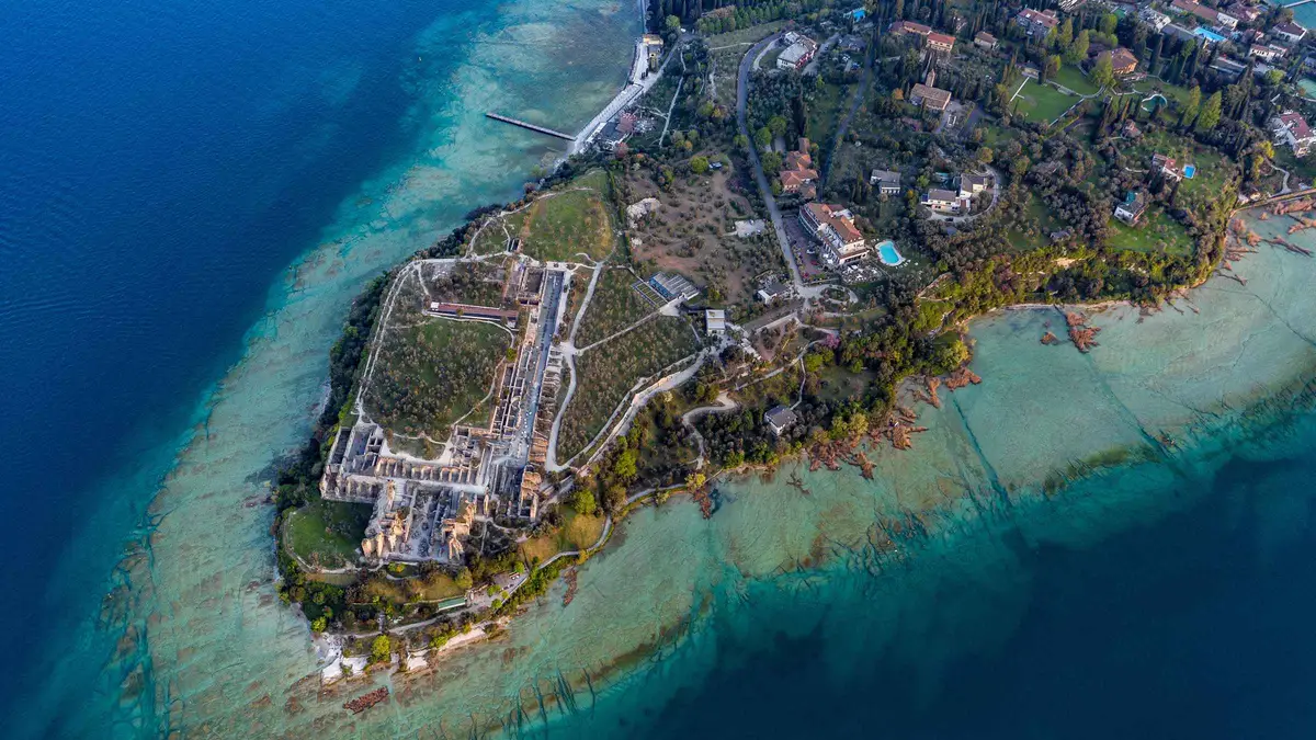
- The quickest look at Sirmione from the water is the 25-minute Sirmione peninsula cruise at $13, which leaves from the small harbour in front of Sirmione Castle and passes the Grottoes of Catullus and Maria Callas Villa.
- The only car ferry on the whole lake is Maderno-Torri, a 30-minute crossing. No car ferry exists on the Malcesine-Limone line. Details on getting around Lake Garda.
- The north tip has no railway station at all. The nearest is Rovereto, with buses on to Riva del Garda, Torbole and Arco. Buy bus tickets before boarding: they cannot be bought on board.
The Map
41 pins in five colours, plotted from Wikidata and OpenStreetMap coordinates. Blue is the towns, red the sights with a ticket, green the free outdoor places and beaches, orange the parks and spas, teal the stations, airports, car ferry, cable car and the island you reach by boat. Tap a pin for its note, or use the list under the map.
Towns 14 pins
- SirmioneThe old town on its peninsula, closed to ordinary traffic in the season. Park at Piazzale Monte Baldo and walk in.
- Desenzano del GardaRailway station on the Milan-Venice line and the ferry company's Garda office. 20 minutes by boat to Sirmione.
- Peschiera del GardaThe second station, start of bus 164 up the east shore, 13 minutes by regional train from Verona.
- LaziseEast-shore town on bus 164, 28 minutes by the morning boat from Peschiera.
- BardolinoWine town on the east shore. Its published tourist tax is $1.68 (€1.50) to $2.79 (€2.50) a night.
- GardaEast-shore town at the end of bus 164, one hour by the morning boat from Peschiera.
- Torri del BenacoEast end of the only car ferry on the lake, 30 minutes across to Maderno.
- MalcesineUnder Monte Baldo, with the cable car and the castle. 20 minutes by boat to Limone.
- Riva del GardaThe north tip in Trentino. No railway station: buses run from Rovereto.
- TorboleThe wind end of the lake, base for windsurfing and sailing.
- ArcoInland from Riva up the valley, reached by the Trentino Trasporti buses from Rovereto.
- Limone sul GardaWest-shore town with the Limonaia del Castèl, 20 minutes by boat from Malcesine.
- Gardone RivieraWest-shore town of the Vittoriale, on the ferry line between Salò and Gargnano.
- SalòWest-shore town on the ferry line, zone 4 from Desenzano at $12.85 (€11.50).
Sights With a Ticket 7 pins
- Sirmione castle$11.17 (€10)The Rocca Scaligera at the gate of the old town. Closed Mondays, under-18s free.
- Grottoes of Catullus$11.17 (€10)Roman villa ruins at the tip of the peninsula. Cards only, Sunday closing at 14:00.
- Roman villa, Desenzano$22.34 (€20) combinedOn the combined ticket with the Sirmione castle and Grottoes, valid 7 days.
- Malcesine castleCastle with a 31 m tower and a natural history museum. Weekends only in November.
- Vittoriale degli ItalianiD'Annunzio's estate above Gardone Riviera, open all year. Tickets sold through its own online shop.
- Cascata del Varone$7.82 (€7)Waterfall gorge near Riva, tickets on site only, closed only on 25 December.
- Limonaia del CastèlLemon house in Limone, open 10-22 from June to September. No price published, phone +39 0365 954008.
Free Outdoors and Swimming 8 pins
- Punta San VigilioA headland north of Garda town. The bay inside its park, Baia delle Sirene, charges entry.
- Strada della ForraThe gorge road up to Tremosine on the west shore.
- Ponale path, Pregasina junctionThe old road from Riva, a hiking path since 2004, 6.4 km and about 3 hours. Bus 214 back from here.
- Jamaica BeachWhite rock below the Grottoes, on foot through the gate before the Grottoes entrance.
- Lido delle BiondeFree cove beach walkable from Sirmione's old town, with bar and hire boats.
- Brema beachLarge grassy beach facing the peninsula, free, with a long jetty.
- Monte Baldo top station1,760 m, about twenty minutes up from Malcesine. Closed 2 November to 25 December.
- Madonna della CoronaSanctuary on a cliff ledge on the Monte Baldo side above the Adige valley.
Parks and Spas 4 pins
- GardalandTheme park just inland from Peschiera. Event seasons change the calendar: check the park's dates.
- MovielandFilm-themed park in the Canevaworld resort near Lazise.
- Parco Giardino SigurtàGarden park at Valeggio sul Mincio, south of the lake.
- Terme di SirmioneThe thermal spa of Sirmione. Entry prices and hours sit on its own page.
Getting In 8 pins
- Desenzano stationMilan-Venice line. Regional to Verona 28 minutes, $5.36 (€4.80).
- Peschiera stationMilan-Venice line. Regional to Verona 19 minutes, $4.52 (€4.05).
- Rovereto stationThe railhead for the north tip. Trentino Trasporti buses to Riva, Torbole and Arco, tickets not sold on board.
- Verona-Villafranca airportAbout 15 km from the lake. Aerobus every 20 minutes to Verona Porta Nuova.
- Brescia-Montichiari airportAbout 30 km from the lake, Aerobus to Brescia station.
- Maderno car ferryWest end of the Maderno-Torri car ferry, 30 minutes, car up to 4.50 m $16.65 (€14.90). The only car ferry on the lake.
- Malcesine cable carValley station of the Monte Baldo cable car. Adult return $33.52 (€30), $31.28 (€28) online.
- Isola del GardaIsland off the west shore, reached only by boat.
Coordinates: Wikidata, OpenStreetMap. Fares: Navigazione Laghi, Ministry of Culture, Trenitalia.
Shortlist: Five Pins Worth the Trip
If the map is too much at once, these five pins carry most of a first visit, chosen for what each one gives that the others do not, from the south shore to the mountain.
| Pin | Colour | Cost | Why it is on the list | Book |
|---|---|---|---|---|
| Sirmione castle | Red | $11.17 (€10) | The gate to the old town and the view down the peninsula | Details |
| Grottoes of Catullus | Red | $11.17 (€10) | The Roman villa at the tip, with Jamaica Beach below it | Check Availability |
| Monte Baldo top station | Green | $33.52 (€30) return by cable car | The whole lake from 1,760 m | Details |
| Malcesine | Blue | Free to walk | The castle, the cable car and the boat to Limone in one town | Check Availability |
| Cascata del Varone | Red | $7.82 (€7) | A waterfall gorge at the north tip, open every day except 25 December | Details |
What the Colours Encode
Each colour answers the one question that decides a day on this lake: can you actually get there, and how.
Most maps group places by type or by town. On Lake Garda the deciding question is not what a place is but how you reach it, because the railway stops at the south shore and the water crossing changes completely with the season. So the pins are coloured by access.
Blue pins are the towns themselves. Red pins are sights with a ticket: Sirmione castle, the Grottoes of Catullus, Malcesine castle, the Vittoriale, the Varone falls, the Limonaia del Castèl and the Roman villa in Desenzano, most of which close on Mondays or keep seasonal hours. Green pins are free outdoors: Punta San Vigilio, Strada della Forra, the Ponale path, Jamaica Beach, Lido delle Bionde, Brema beach, the Monte Baldo top station and Madonna della Corona.
Orange pins are parks and spas: Gardaland, Movieland, Parco Sigurtà and Terme di Sirmione. Dark teal pins are the arrival points, from the stations and airports to the car ferry and the Malcesine cable car. Before you plan around the red ones, check tickets.
How the Lake Is Shaped
The lake is one body of water with three completely different ends, and the map shows it.
The Wide South
The southern basin is low moraine country, hills of gravel and clay dumped by the retreating ice, and it is the only part of the lake with a railway. Desenzano and Peschiera del Garda sit on the Milan-Venice line, so nearly every train traveller arrives here. Sirmione lies on a long narrow peninsula reaching into the water from the south shore, its castle and Roman ruins at the far tip.
Gardaland sits just inland between Peschiera and Lazise, which makes the south the natural base for families with small children and for anyone without a car. Read more on Sirmione and Peschiera del Garda.
The Narrow North
North of the wide southern basin the lake narrows into a fjord squeezed between high mountains, and the water ends at the Trentino towns of Riva del Garda and Torbole. Arco sits a short way inland up the valley. No railway reaches any of these towns: the nearest station is Rovereto, and regular Trentino Trasporti buses cover the last stretch to Riva, Torbole and Arco.
This is the wind end of the lake, where the sailing and windsurfing schools cluster, and the walking country starts at the door. The shape matters for planning, because a boat ride from the south to Riva takes hours, while the drive from the south swings around the whole lake. See Riva del Garda and Torbole.
East and West
The east shore is Veneto: Lazise, Bardolino, Garda, Torri del Benaco, then Malcesine sitting under Monte Baldo, all linked by ATV buses from Verona. The west shore is Lombardy: Salò, Gardone Riviera with the Vittoriale, and Limone sul Garda near the north. Between them the boats do the crossing in season, and the Maderno-Torri car ferry links the two shores all year.
The lake surface sits at 65 m above sea level and the water is 346 m deep at its deepest point, and the shore keeps a mild, Mediterranean-type climate with olives and lemons at the foot of the Alps. Compare Malcesine and Limone sul Garda when choosing a side.
Source: VisitGarda, Garda Trentino.
Distances in Boat Minutes
No official source prints drive times between the towns, so this map measures distance the way the lake actually moves you: in boat minutes from the summer timetable.
The summer passenger timetable ran from 16 May to 4 October, and its runs are the most honest ruler for this map. Desenzano to Sirmione takes 20 minutes by ordinary ferry. On the east shore a morning run leaves Peschiera at 8:00 and reaches Garda at 9:00, calling at Lazise at 8:28 and Bardolino at 8:45, one hour end to end with two stops.
Across the narrowing north, Malcesine to Limone takes 20 minutes and Malcesine to Riva 65 minutes. For the whole length, the ordinary boat from Peschiera to Riva takes close to 5 hours, stopping at everything on the way, while the fast boat does Desenzano to Riva in under 3 hours. Fast services cost the ordinary fare plus a zone supplement of $2.79 (€2.50) to $6.70 (€6), with no reductions.
The whole-lake day pass at $44.13 (€39.50) is the only pass that includes the fast boats, and a 3-day version costs $88.26 (€79). Fares run $1.68 (€1.50) to $19.55 (€17.50) one way by zone. Full times and lines are on the ferry page.
The table below gathers the key legs, so read each one as water time, not road time.
| Leg | Boat | Time on the water | One-way fare |
|---|---|---|---|
| Desenzano to Sirmione | Ordinary | 20 min | $3.91 (€3.50), zone 1 |
| Peschiera to Garda via Lazise and Bardolino | Ordinary | 1 h (8:00 to 9:00) | See the zone table |
| Malcesine to Limone | Ordinary | 20 min | $8.38 (€7.50), zone 3 |
| Malcesine to Riva del Garda | Ordinary | 65 min | $12.85 (€11.50), zone 4 |
| Peschiera to Riva del Garda | Ordinary | close to 5 h (9:10 to 14:00) | See the zone table |
| Desenzano to Riva del Garda | Fast, with supplement | under 3 h (9:20 to 12:15) | $19.55 (€17.50) plus $6.70 (€6) |
| Maderno to Torri del Benaco | Car ferry | 30 min | $8.38 (€7.50) per adult, car to 4.50 m $16.65 (€14.90) |
Source: Navigazione Laghi summer timetable, Navigazione Laghi fares.
What No Road Reaches
Four of the best pins on this map cannot be driven to, and that is exactly why they earn their place.
Isola del Garda
Isola del Garda sits off the west shore near Salò and is reached only by boat. The straightforward way in from the south is the private boat tour of Isola del Garda, which costs $496.04 per boat for a 1.5-hour circuit taking in Sirmione, the Rocca di Manerba and the Isola di San Biagio as well. A parking fee applies and is not included in the listed price, so budget for it separately if you drive to the departure point.
The tour is subject to good weather, and a cancelled departure is moved to an alternative date. Full visiting detail is on Isola del Garda.
The Monte Baldo Top Station
The summit pin above Malcesine sits at 1,760 m on Monte Baldo, and the only way up without a full day's hike is the cable car, which climbs from the lakefront in about twenty minutes. The adult return fare is $33.52 (€30) at the ticket office and $31.28 (€28) online, so buying online saves a little. Juniors born 2012 or later pay $20.11 (€18) return.
The ride shuts down completely from 2 November to 25 December for maintenance, and departures run only when the weather allows. Both official pages give different last-ride times, so check the day's timetable before planning a descent. The walking country above is on Monte Baldo.
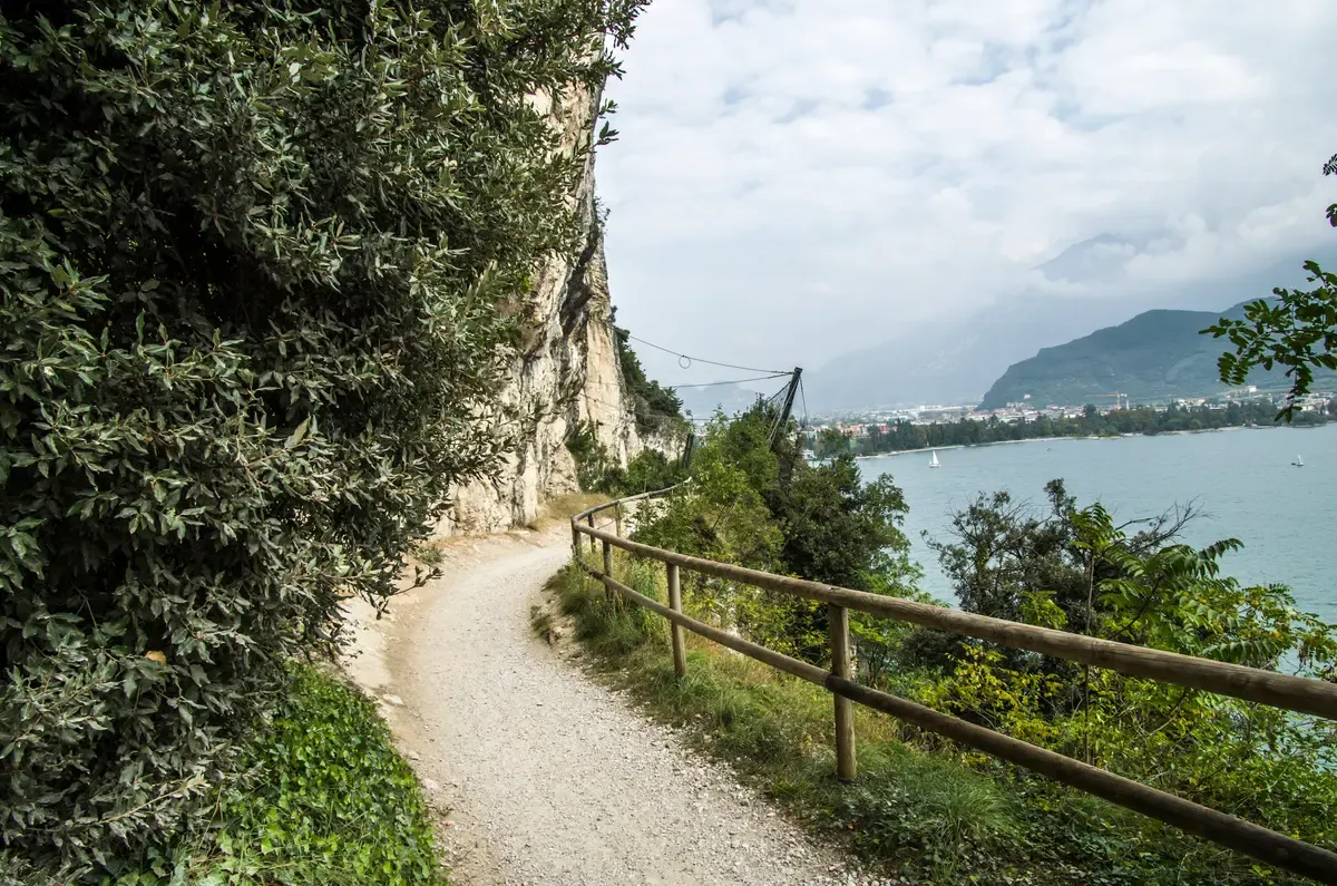
A railed gravel path on the cliff above the lake near Riva del Garda, with the town and Monte Brione behind. Photo: BirdsEyeLV, CC BY-SA 3.0, via Wikimedia Commons
The Ponale Path
The green pin on the west wall above Riva marks a path that began life as an engineering feat: a road begun in 1851, fortified by the Austro-Hungarians from 1860, and closed to traffic and handed to hikers in 2004. From Riva it runs 6.4 km with about 3 hours of walking and a highest point of 532 m, and the official listing calls it easy. The safety note is blunter: it is an alpine trail prone to rockfall, for experienced hikers.
Bus 214 picks up again at the Pregasina junction if you want to walk only one direction. The falls at the same end of the lake are on Cascata del Varone and the Ponale path.
Jamaica Beach
This green pin below the Grottoes of Catullus on the Sirmione peninsula has no road access at all. You reach it on foot, through the gate just before the Grottoes entrance and then down a steep dirt path through an olive grove. The surface is smooth white rocks rather than sand, part of the beach is free and part carries sun beds for hire, and there are free showers.
Dogs on a leash are allowed, and fires and camping are not. It is the sort of pin that looks close to everything on the map and takes real effort to arrive at, which is the point of colouring it green. More swimming spots are on Lake Garda beaches.
Source: Funivia Malcesine-Monte Baldo, Garda Trentino, Ponale path, Visit Sirmione, Jamaica Beach.
The Gaps, and Why Each One Is a Finding
What this map leaves off is deliberate, and each gap tells you something about planning a trip here.
No Hotel or Restaurant Pins
A map that pinned whichever hotels or restaurants happened to be easiest to find would quietly become a ranking, and that is not what an access map is for. So no beds and no tables appear here. The bases are compared properly on where to stay, town by town, and the eating is handled on where to eat, with a separate page for restaurants in Sirmione.
Use the coloured pins to decide which shore suits your transport plan first, then pick the bed.
No Drive Times
No official source prints drive times between the towns on this lake, and inventing them would break the one rule this map keeps. So the distances here are given in boat minutes from the ferry operator's own summer timetable, which is measured, published, and the same for everyone. For scale, remember that the shoreline runs 158.40 km in total, and the road between the south-east corner and the north tip has to swing around the whole shape.
Where a drive estimate matters for your own plan, use a routing app on the day and treat every published figure here as water time.
Day Trips Off the Frame
Verona, Venice, Mantua and the Dolomites all sit beyond the edge of this map, and they stay off it on purpose, because dragging them in would blur the lake shape that the pins are there to show. The practical routes and times are gathered on day trips from Lake Garda. If you want the easy version, the Verona coach day at $73 runs 8-10 hours with round-trip transfers from spots including Limone, Lazise and Riva del Garda, and the Dolomites coach day at $95 covers Pordoi Pass and Ortisei with hotel pickup.
Beaches Beyond Sirmione
Only beaches described by an official tourism source are pinned here, which is why the green swimming pins cluster so heavily around Sirmione: its own tourism office lists seven beaches by name, including Jamaica Beach, Lido delle Bionde and Brema. The Trentino board lists 17 beaches in its area, so the north has swimmable pins too. Other stretches of shore certainly exist, but without an official description they stay off the map, and you should not read their absence as a verdict on the water.
The full rundown is on Lake Garda beaches.
What the Season Changes
This map is honest for the boating season, and wrong in a specific way for the winter months.
Every boat minute on this page comes from the summer timetable, and from 2 November to 12 March those minutes stop meaning anything: no passenger boats run anywhere on the lake. The only service left is the Maderno-Torri car ferry, a 30-minute crossing whose winter timetable starts at 8:10 from Maderno and 8:45 from Torri, with the last runs at 18:00 and 18:40. It does not run on 25 December, and its one-way fare is $16.65 (€14.90) for a car up to 4.50 m with the driver included, $8.38 (€7.50) per adult passenger.
The Monte Baldo cable car closes from 2 November to 25 December, so its teal pin goes dark for the same stretch. The red ticketed sights keep their own rhythm: Sirmione castle and the Grottoes of Catullus close on Mondays all year, and Malcesine castle drops to weekends in the cold months. Winter changes the map's meaning, and the lake in winter sets out what still works.
Source: Navigazione Laghi car ferry timetable, Funivia Malcesine-Monte Baldo, Visit Malcesine.
Cross the Map by Boat or Coach
Two boats that cover the south end of the map, one sailboat on the north, the island you can only reach by water, and the coaches that leave the frame. Prices are the operators' listed US dollar prices. Figures current in Q4 2026.
 from $13
Editor's pick
Sirmione: 25 Minute Boat Cruise around the Peninsula
A short and cheap 25 minute loop around the Sirmione peninsula with captain narration, run by the operator based at the castle harbor.
Check Availability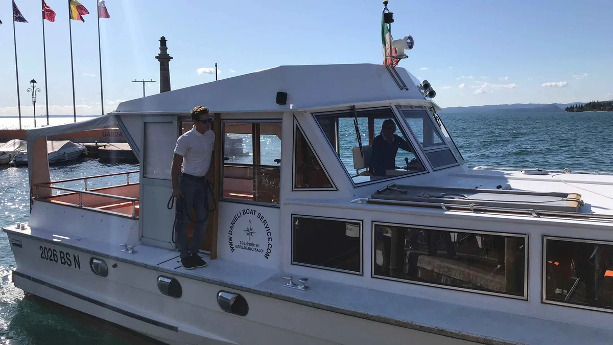 from $61
Lake Garda: 4-hour Guided Boat Cruise with Stop in Sirmione
A four-hour guided Lake Garda cruise with a two-hour free-time stop in Sirmione, photo stops along the shore and a guide in English or German.
Check Availability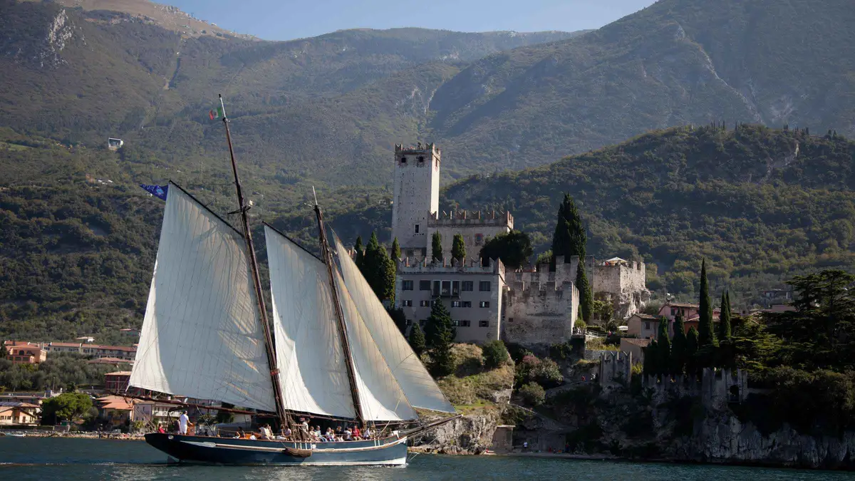 from $45
Malcesine: Panoramic Cruise on Historical Sailboat
A 2-hour sailing cruise on a historic Lake Garda sailboat from Malcesine, with views of the La Forra waterfalls near Tremosine.
Check Availability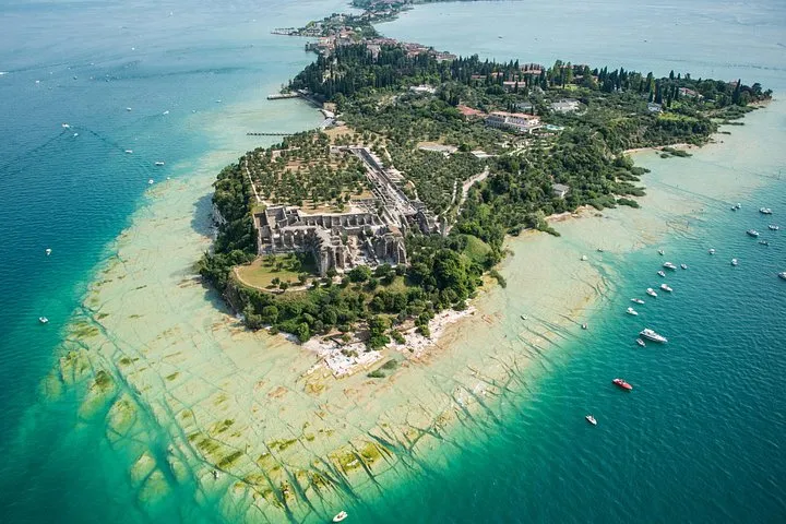 from $496.04
Boat Tour of Isola del Garda
A short private 1.5-hour boat circuit around Garda Island and Sirmione with a guide and Prosecco included.
Check Availability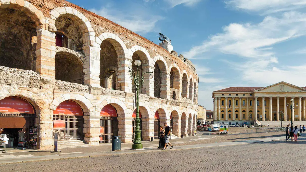 from $73
Verona Full-Day Tour from Lake Garda
A coach day trip from Lake Garda resorts to Verona with a 1.5-hour guided walk and free time, from $73 per person.
Check Availability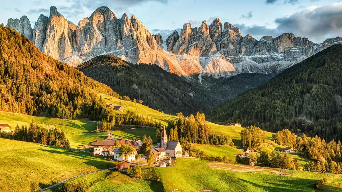 from $95
Dolomites Full-Day Tour from Lake Garda
A long 10-12 hour coach day from Lake Garda to Pordoi Pass and Ortisei with an optional €28 cable car, from $95 per person.
Check AvailabilityPrices, ratings and details are the platform's own. Dollar figures are the listed prices. The platform bills in your account's currency.
Where to Go Next
The pages behind the pins.
Things to Do in Lake Garda
The red and green pins in detail. See what to see in Lake Garda.
Getting Around Lake Garda
Trains, buses and boats between the pins. See getting around.
Lake Garda Map: Questions
Which side of Lake Garda is on which region's map?
The east shore, from Peschiera through Lazise, Bardolino, Garda, Torri del Benaco and Malcesine, is Veneto. The west shore, from Desenzano and Sirmione through Salò, Gardone Riviera and Limone, is Lombardy. The north tip around Riva del Garda, Torbole and Arco is Trentino. The map's blue pins sit across all three, so pick your base by transport first. Compare the Lake Garda towns side by side. If you're choosing where to stay, browse hotels on Lake Garda.
What is the main town on a Lake Garda map?
There is no single main town. The lake is 51.60 km long and split between three regions, so importance is practical rather than official. Desenzano del Garda holds the ferry operator's Garda office, Peschiera and Desenzano have the only railway stations, and Riva del Garda anchors the north. For choosing, see Desenzano del Garda.
Can you walk all the way around Lake Garda?
The shoreline runs 158.40 km in total, but no official round-the-lake path is printed here, so treat a complete walking circuit as an unsupported project rather than a marked route. Some individual stretches are excellent, such as the Ponale path from Riva at 6.4 km and about 3 hours. For tested routes with distances and difficulty, see Lake Garda hiking.
How long does the boat take from one end of Lake Garda to the other?
It depends which boat you pick. The ordinary boat from Peschiera to Riva takes close to 5 hours, calling at every stop along the way. The fast service from Desenzano to Riva does the same length in under 3 hours, with a zone supplement on top of the ordinary fare. These times come from the summer timetable, and the whole-lake day pass at $44.13 (€39.50) is the only pass that covers fast boats. Times are on the ferry page.
Is there a printable map of Lake Garda?
Yes. The official tourism portal keeps a download page with brochures and printable material covering the lake, which you can save before you travel. This page's own map works on a phone, and its boat minutes come from the official summer timetable. Grab the official downloads and then check getting around Lake Garda for how the pieces connect.
Where is Sirmione on a map of Lake Garda?
Sirmione sits on the south shore between Desenzano and Peschiera, on a long narrow peninsula that reaches out into the lake. On this map it appears several times in different colours: a blue town pin, red pins for the castle and the Grottoes of Catullus, and green pins for Jamaica Beach and Lido delle Bionde. It is 20 minutes by boat from Desenzano. Plan it on Sirmione.
The Lake's Shape on Film
Three drone films that show the shape the map flattens: the wide south, the west shore and the east shore towns.
Lago di Garda- Garda lake 4K cinematic Film by drone
A drone film over the lake that shows how it narrows from south to north.
Video: Samuel GheteToscolano Maderno Garda Lake, Italy Drone Footage in 4K - 2022 Drone Tours
Toscolano-Maderno from the air, the west end of the only car ferry.
Video: Drone Tours ChannelMy Drone Stories | Garda, Lake Garda | A Beautiful Italian Lakeside Town
Garda town on the east shore filmed from above.
Video: Camo ProductionsVideos load from YouTube only when you press play. Third-party films, not made by this site.
Prices, hours and terms are set by the venue or operator and confirmed at checkout.
We may earn a commission if you book through one of our links, at no extra cost to you. Full affiliate disclosure