 Lake Garda Travel Guide
Lake Garda Hiking: Trails, Grades and How to Reach Them
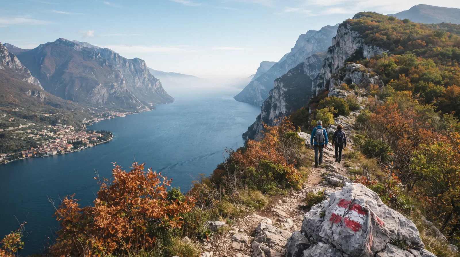
Lake Garda hiking splits in two. The steep trails crowd the northern tip around Riva and Torbole, where Garda Trentino lists over 70 signposted routes. The south and west shores stay gentler, and Monte Baldo adds a whole mountain reached by cable car. This page sorts the trails by effort and by how you get back without a car. For the wider picture of what to see in Lake Garda, see things to do in Lake Garda.
Quick answer which trails suit your legs and transport
The north shore hikes run from the 7.9 km Busatte-Tempesta loop, graded easy, to the EE edge path at Punta Larici. Garda Trentino gives the Ponale path from Riva as 6.4 km and about 3 h one way, with bus 214 for the return.
Key takeaways
- The Monte Baldo trails start at the top station, so budget the return fare from Monte Baldo tickets before you plan the day.
- If you want a guide on the water or in the hills instead, browse Lake Garda tours.
- Base yourself in Riva or Torbole for the north shore walks, see where to stay.
Fifteen Marked Trails Side by Side
Length, time, climb and grade for each trail as published by Garda Trentino, the Monte Baldo cable car operator and Italia.it. Blank cells are figures the source does not give.
| Trail | Distance | Time | Climb | Grade |
|---|---|---|---|---|
| Busatte-Tempesta, Torbole | 7.9 km loop | 2 h 40 min | +305 m | Easy, about 400 iron steps |
| Ponale path from Riva | 6.4 km | about 3 h | +736 m / -272 m | Alpine trail, rockfall risk |
| Punta Larici loop, Pregasina | 6.5 km | 3 h 30 min | +478 m | Intermediate, EE edge path |
| Forts of Monte Brione | 6.1 km | 3 h | +375 m | Easy |
| Monte Altissimo from Nago | 8.6 km | 4 h | +761 m | Intermediate |
| Monte Stivo | 9.7 km | 4 h | +850 m | Intermediate |
| Malcesine Peak loop, Monte Baldo | 3.6 km | 2 h | 260 m | Easy |
| Ventrar trail, Monte Baldo | 5 km | 2 h | 500 m | Challenging, EE |
| Cima Pozzette, Monte Baldo | 7 km | 3 h | 400 m | Intermediate |
| Malga loop, Monte Baldo | 7.5 km | 3 h | 450 m | Intermediate |
| Cima Valdritta or Telegrafo | 9 km each way | 4 h each way | Challenging | |
| Prà Alpesina nature trail | 3.6 km | 1 h 15 min | 422 m down | Easy |
| Sentiero del Sole, Limone | almost 9 km | 3-4 h | about 500 m | Simple |
| Rocca di Manerba | 5.5 km | about 2 h | Signposted park paths | |
| Tibetan bridge from Crero | about 20 min | Easiest of four routes |
Source: Garda Trentino, Funivia Malcesine-Monte Baldo, Italia.it.
The North Shore Trails Above the Fjord
Garda Trentino lists over 70 signposted routes, from gentle lakeside strolls to demanding ridgelines, plus long-distance trails such as GardaTrek, LedroTrek and the Cammino di San Rocco. The five walks below are the ones most hikers come for.
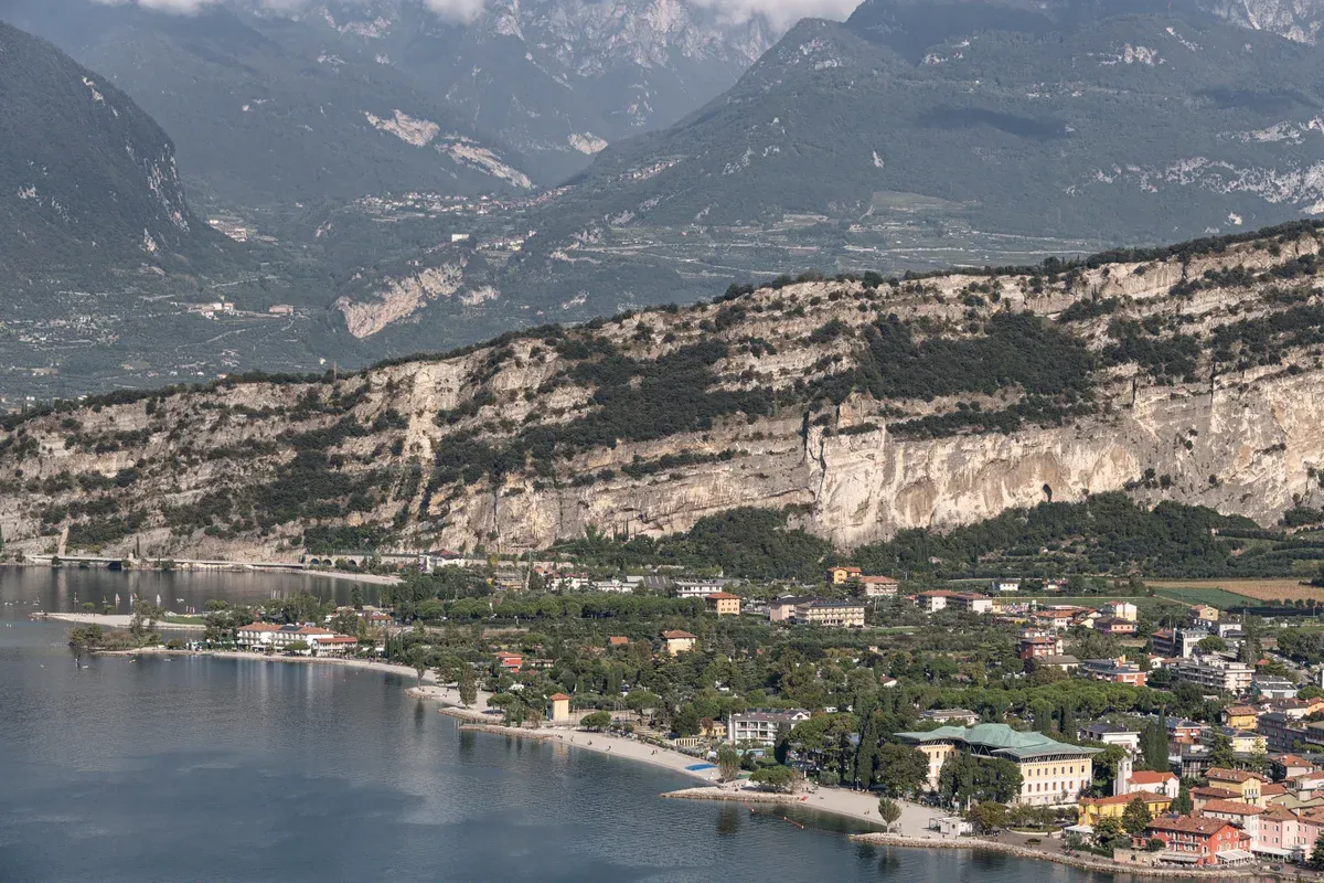
Torbole and the cliffs of Monte Brione from the Busatte-Tempesta trail. Photo: Giorgio Galeotti, CC BY 4.0, via Wikimedia Commons
Busatte-Tempesta Trail
This was a border walk. Under Austria-Hungary, Tempesta marked the Italian frontier, and the trail now runs along the same rock walls above Torbole. The loop is 7.9 km with 305 m of climb, highest point 364 m, graded easy and family-friendly.
The iron stairways bolted to the cliff total about 400 steps, which children tend to love and vertigo sufferers should test slowly. The one-way route from Busatte Park covers 4 km in about 90 minutes over two climbs, Corno di Bò and Salt de la Cavra, to Tempesta. Walk back on the forest road or take the bus to Torbole from the main road at Tempesta, which saves the return climb.
Parking sits at località Busatte. Torbole makes a good end point, read more in Torbole.
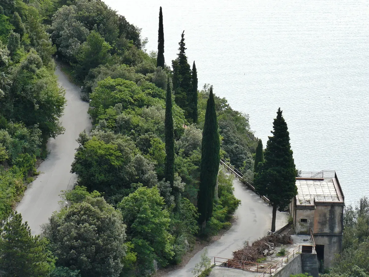
Hairpins of the old Ponale road above the lake. Photo: qwesy qwesy, CC BY 3.0, via Wikimedia Commons
The Ponale Road on Foot
The Ponale road was begun in 1851 to link Lake Garda with Lake Ledro. Austro-Hungarian fortifications from 1860, the Tagliata del Ponale, sit visible at the second and third tunnels, normally closed to the public. The road carried traffic until the late 1980s and became a hiking path in 2004.
Garda Trentino gives 6.4 km and about 3 h from Riva, with 736 m of climb and 272 m of descent, highest point 532 m. Start by the Riva hydroelectric power station, just before the tunnel on the left. The path is shared with bikers, not for prams, dogs on a leash.
It is an alpine trail for expert hikers with no technical difficulty but prone to rockfall. The Belvedere refreshment stop opens in summer only. Return on bus 214 from the Pregasina junction on the SS240.
The waterfall and the path's start are covered in the Cascata del Varone guide, and the town in Riva del Garda.
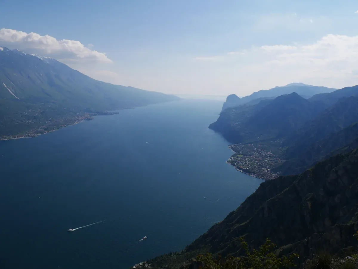
Lake Garda looking south from Punta Larici. Photo: Tiziano.grottolo, CC BY-SA 4.0, via Wikimedia Commons
Punta Larici Loop From Pregasina
The SAT 422A trail, called Senter de la Costa, follows a Great War route along the rock wall above the lake. The loop through Pregasina, Punta Larici and Malga Palaer runs 6.5 km in 3 h 30 min with about 478 m of climb, highest point 972 m, graded intermediate. The section to Punta Larici itself is classified EE, meaning expert hikers only, with exposed stretches along the rock wall, some fixed with a metal cord.
Vertigo-prone hikers should take the woodland path SAT 422 instead and skip the point. Free parking sits near the church in Pregasina. Bus 214 links Riva and Pregasina, but runs are not frequent, so check times the day before.
From Riva by the Ponale road to Pregasina on foot takes about 1 h 30 if you want to make it a through walk.
The Forts of Monte Brione
Monte Brione, 376 m, separates Riva from Torbole, and its ridge carries four Austro-Hungarian forts built across half a century. Forte San Nicolò dates from 1860 to 1862, Forte Sant'Alessandro from 1881, Batteria di Mezzo from 1900 and Forte Garda from 1907. The walk is 6.1 km with 375 m of climb, about 3 h, graded easy and family-friendly.
The hill is also a nature reserve with 817 plant species, 35 percent of Trentino's flora, and 26 orchid species, which is why the summit is a protected reserve. Forte Garda opens with guided tours from May to October via the Sentiero della Pace from San Nicolò, booked through MAG Museo Alto Garda. Start from Riva and finish with a swim, see Riva del Garda.
Monte Altissimo From Nago
This is the serious one of the five. The route from Nago to the summit of Monte Altissimo runs 8.6 km out and back with 761 m of climb and about 4 h of walking in all, graded intermediate. The summit sits at 2,069 m and there is a refreshment stop at the Damiano Chiesa refuge on the way.
The trail forms part of the Sentiero della Pace, the Peace Path, through the Monte Baldo Local Nature Reserve, a range known since the 15th century as the Garden of Europe. On a clear day you look straight down the lake. Nago sits above Torbole, so you can sleep down at the shore and drive or bus up in the morning.
More on the range in Monte Baldo.
Source: Garda Trentino hiking, Sentiero Busatte-Tempesta, Ponale path, Punta Larici loop, Forts of Monte Brione, Monte Altissimo.
Trails From the Top of the Cable Car
The Malcesine to Monte Baldo cable car lifts you to Tratto Spino at 1,760 m in about twenty minutes, and the operator publishes six routes from the top station. The adult return costs $33.52 (€30) at the ticket office or $31.28 (€28) online. The car closes for maintenance from 2 November to 25 December, and two official pages give different last-ascent times, so check the day's timetable at the station. The ticket is valid one day, is not refundable and gets no refund for wind or technical faults.
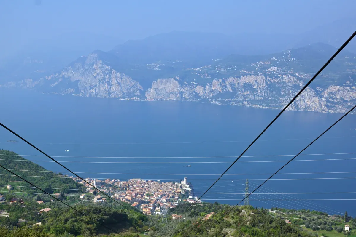
Malcesine and the lake from the Monte Baldo cable car. Photo: Allie_Caulfield from Germany, CC BY 2.0, via Wikimedia Commons
Malcesine Peak Loop
The easiest of the top-station routes and the best first mountain walk for mixed groups. The loop covers 3.6 km in about 2 h with 260 m of climbing, graded easy. You start and finish at Tratto Spino, the top station at 1,760 m, so the cable car does all the climbing from the lake.
Because it is a loop, you can cut it short and still ride down. See the town below in Malcesine.
The Ventrar Trail
The operator grades the Ventrar as challenging. It runs 5 km in about 2 h with 500 m of climbing, and CAI classifies it EE, meaning expert hikers only. Exposed sections are secured with a steel cable and the operator states plainly that it is not for vertigo sufferers.
The operator warns that weather changes suddenly on the ridge, so go early in the day and check the cable car timetable for the return before you set off.
Cima Pozzette and the Malga Loop
Two intermediate options for a longer half day. The Cima Pozzette route runs 7 km in about 3 h with 400 m of climbing to the summit at 2,125 m, returning the same way. The Malga tour loop is 7.5 km, about 3 h, with 450 m of climbing.
Monte Baldo holds over 60 orchid types blooming from March to August by altitude, plus edelweiss, wild peony and the Monte Baldo anemone. Golden eagles, chamois and marmots live on the ridge. Ticket rules and prices in Monte Baldo tickets.
The Long Ridge to Cima Valdritta
The big day. Cima Valdritta is the highest peak of Monte Baldo at 2,218 m, with Cima Telegrafo at 2,200 m and the Rifugio Telegrafo Gaetano Barana nearby. From the top station the operator lists 9 km and 4 h each way, graded challenging, so count on a full day and a fit set of legs.
The ridge itself runs 40 km beside the lake, and the range carries the name of the Sentiero della Pace, the long-distance Peace Path. Weather changes suddenly up here, so the operator advises proper clothing, hiking shoes, hat, water and snacks, and a check of the cable car return time before committing. If the ridge is clouded in, the coach day to the Dolomites full day from the lake gives you big mountains without the exposure.
Source: Funivie del Monte Baldo excursions, Timetables and fares, Monte Baldo nature, Safety FAQ.
Gentler Walks on the East, South and West Shores
The south and west shore trades cliff stairs for olive groves, castle ruins and one very short suspension bridge. These four walks need no cable car and little planning.
The Tibetan Bridge Above Torri del Benaco
Near the hamlet of Crero, a steel suspension bridge opened in 2019 hangs 45 m above the lake. Four routes reach it, and the easiest starts from the car park just before Crero and takes about twenty minutes, so the headline photo costs less than half an hour of walking. The bridge joins CAI paths 38 and 39 on the mid-slope path linking Malcesine and Garda, so you can stretch the visit into a proper half-day hike between the two towns.
No fee is listed for the bridge on the national tourism portal. The nearest town guides here are Garda and Malcesine.
Rocca di Garda
This rocky hill above Garda gave the whole lake its name. Before the early Middle Ages the lake was called Benaco, then a castle on the Rocca renamed it. The hill has two summits, the Rocca vecchia at 294 m, almost sheer over the water, and the Eremo at 309 m, ringed by pines and a wall.
A Camaldolese hermitage stands on the Rocca. The Rocca also gives its name to La Rocca, the lakeside subzone of the Bardolino wine country, so a walk here pairs with an afternoon tasting, see Bardolino wine and Bardolino.
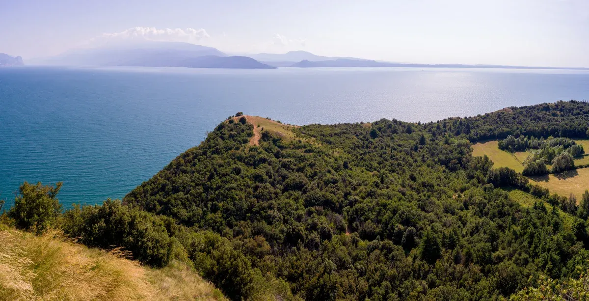
Punta Sasso in the Rocca di Manerba park above the lake. Photo: Wolfgang Moroder, CC BY-SA 3.0, via Wikimedia Commons
Rocca di Manerba
On the south-west shore, the walk crosses the Natural Park of the Rocca di Manerba over the Sasso plateau to the castle ruins. The route is 5.5 km, about two hours, and well signposted, which makes it one of the few walks on the lake you can start without studying a map. The ruins crown the rock above the lake on the Lombard shore between Desenzano and Salò.
It pairs well with a morning in Sirmione or an afternoon in Salò.
Sentiero del Sole From Limone
The Sun Trail climbs through olive groves above Limone sul Garda. Italia.it gives almost 9 km with about 500 m of height difference and 3 to 4 hours, following signs for Sentiero del Sole and Ciclabile del Garda 135. At a fork on the way, Italia.it points left to the Sopino waterfall.
Limone is reachable by boat from Riva in season, zone 2 on the ferry fare matrix at $6.70 (€6), so the walk works without a car, see the ferry fares.
Source: Italia.it Lake Garda walks, Bardolino wine consortium.
Guided Days for Walkers
No guided hike is sold for the lake trails themselves. These three cards are the nearest thing: a sanctuary walk on the Monte Baldo side, a canyon descent from Arco, and a long coach day to the Dolomite passes.
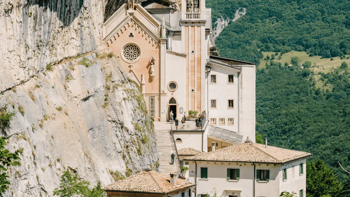 from $148
From Verona: Day tour to Madonna della Corona
A 5 to 6 hour small-group trip for 8 people that pairs the cliff sanctuary visit with a long included lunch on Monte Baldo.
Check Availability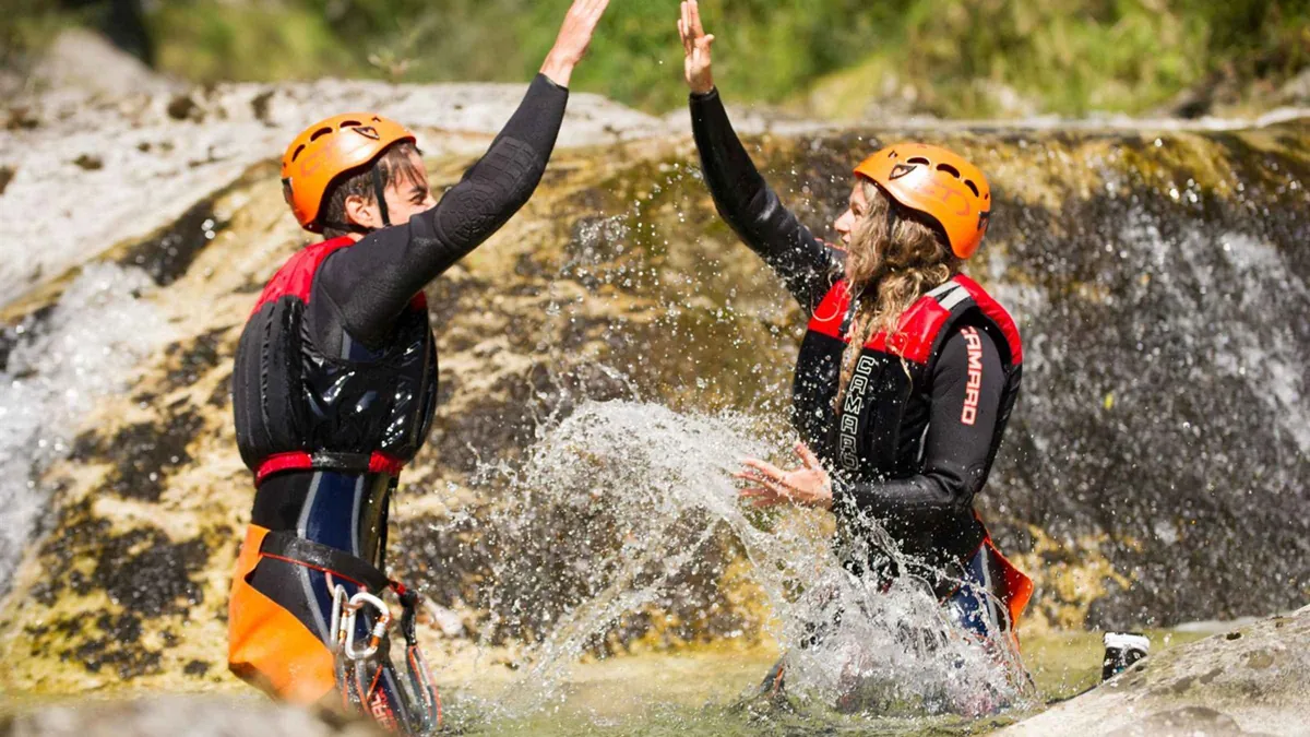 from $111
Arco: Wild Jump Canyoning with Jumps or Guided Rope Descents
A 3.5 hour beginner-friendly canyon descent near Arco with optional jumps or rope descents, full gear and a courtesy transfer included.
Check Availability from $95
Dolomites Full-Day Tour from Lake Garda
A long 10-12 hour coach day from Lake Garda to Pordoi Pass and Ortisei with an optional €28 cable car, from $95 per person.
Check AvailabilityPrices as listed on the booking platform. Figures current.
Prices, ratings and details are the platform's own. Dollar figures are the listed prices. The platform bills in your account's currency.
Which Trail for the Time You Have
Most visitors have one walking day and want the best return on it. The table below matches six headline trails to the hours you actually have, including the way back.
Times are one-way or loop as marked by the route operator. Allow extra for bus waits at Pregasina and Tempesta.
| Time you have | Trail | Start | Getting back |
|---|---|---|---|
| Half day, easy | Monte Brione forts loop, 3 h | Riva del Garda | Walk back down to Riva |
| Under 3 h, easy | Busatte-Tempesta, 2 h 40 min loop | Busatte Park, Torbole | Forest road or bus from Tempesta to Torbole |
| Half day, hard | Punta Larici loop, 3 h 30 min | Pregasina | Same trailhead, bus 214 to Riva is infrequent |
| Most of a day | Ponale path, about 3 h one way | Riva power station | Bus 214 from the Pregasina junction on the SS240 |
| Half day from the cable car | Malcesine Peak loop, 2 h | Top station, Tratto Spino | Cable car down, last ride per the day's timetable |
| Full day | Monte Altissimo, 4 h out and back | Nago | Out and back, same route down |
When the day is short, drop Monte Altissimo and Cima Valdritta first: each needs about 4 hours on foot before travel is added (our estimate of the day). The Malcesine Peak loop gives you mountain scenery for two hours of walking plus the cable car ride, and it works even in a morning. If the Punta Larici bus 214 timetable looks thin for your date, swap it for Busatte-Tempesta, which has a bus back from Tempesta and needs no timetable gymnastics.
Brione is the standby for a late start, since it begins and ends in Riva on foot.
Source: Garda Trentino hiking, Funivie del Monte Baldo excursions.
When to Walk and What the Season Shuts
Spring and autumn suit the exposed north trails, where summer heat on the rock walls is punishing. Italia.it flags Busatte-Tempesta and the Ponale as walks best taken outside high summer.
The Cable Car Closure
The Malcesine to Monte Baldo cable car shuts for maintenance from 2 November to 25 December. Winter running resumes from 26 December to 21 February, then the summer season runs from 4 April to 1 November. Two official pages give different last-ascent times, so check the day's timetable at the station before you commit to a long ridge walk.
The ticket is not refundable and gets no refund for wind closures, so a windy forecast can cost you the full fare. If the mountain is shut, the gondola-free alternatives are Nago to Monte Altissimo on foot, or the small-group Madonna della Corona day from Verona, which spends two hours at the sanctuary on the Monte Baldo side with lunch included and no cable car.
The Ferry Gap
From 2 November to 12 March the only service on the whole lake is the Torri-Maderno car ferry. There are no passenger boats in that window. That kills the classic boat-assisted hikes, such as riding the ferry to Limone and walking the Sentiero del Sole, or crossing to Malcesine for the cable car.
In winter, plan hikes you can start from your front door, which is another reason to base in the north. Details of the winter lake in Lake Garda in winter.
Flowers and the Ponale Belvedere
Monte Baldo earns its name, the Garden of Europe, with over 60 orchid types blooming from March to August depending on altitude, alongside edelweiss, red lily and wild peony. On the Ponale, the Belvedere refreshment stop opens in summer only, so carry food outside that window. For month-by-month detail see the best time to visit.
The operator asks walkers on the mountain not to move signs, roll stones or pester animals, and to keep dogs on a leash, which matters most in the flowering months when the slopes are busiest. Golden eagles, chamois and marmots live on the ridge.
Source: Funivie del Monte Baldo homepage, Ferry winter timetable, Italia.it Lake Garda walks, Monte Baldo nature.
Grades, Gear and Staying Safe
Two grading systems appear on these trails. Garda Trentino labels routes easy or intermediate, while the CAI grades the hardest sections EE. Know which you are booking before you set off.
What EE Means
EE is the grade Garda Trentino and the cable car operator use for routes meant for expert hikers. On Lake Garda that means the Punta Larici section of the SAT 422A and the Ventrar trail on Monte Baldo, both with exposed stretches along rock walls, some secured with a metal cord. Neither needs climbing gear, but both need a head for height and sure feet.
Vertigo-prone hikers have documented alternatives on both routes, the woodland path SAT 422 at Larici and the easy Malcesine Peak loop on Baldo.
The Kit List
Garda Trentino advises a day rucksack of 25 to 30 litres with snacks, a spare t-shirt and socks, long trousers and a whistle. The Monte Baldo operator adds proper clothing, hiking shoes, a hat and water, and warns that weather changes suddenly on the ridge. Choose routes that suit your ability, carry a detailed map, check the forecast, do not walk alone or at least tell someone your route, turn back in doubt and never leave marked paths.
For route information phone Garda Trentino on +39 0464 554444. Garda Trentino also warns that the Ponale path is prone to rockfall.
- Pick a route that matches your fitness and head for heights
- Carry a detailed map, not just a phone
- Check the weather forecast before you leave
- Do not walk alone, or tell someone your route
- Turn back when in doubt
- Stay on marked paths
- Pack a 25 to 30 litre rucksack with snacks, spare clothes and a whistle
If you would rather take the exposure with a guide, the Rio Nero canyoning descent from Arco runs 3.5 hours of water slides and rope descents in the Ledro Valley with an Alpine guide, full equipment included, for weights between 40 and 120 kg.
Source: Garda Trentino safety advice, Monte Baldo FAQ, Ponale path.
Reaching the Trailheads Without a Car
Most of these trails start where public transport actually goes, and the north shore cluster works well one way on foot with a bus or boat back. The table gives the fare for each leg.
Fares are the published single or return prices per adult. Zone figures come from the ferry fare matrix.
| Trail | Public way in | Way back | Fare |
|---|---|---|---|
| Busatte-Tempesta | Bus or ferry to Torbole | Bus from Tempesta to Torbole | Ferry Riva to Torbole, zone 1, $3.91 (€3.50) |
| Punta Larici loop | Bus 214 from Riva to Pregasina, infrequent | Same bus back, check times | Trentino Trasporti bus, buy the ticket before boarding |
| Ponale path | Walk from Riva power station | Bus 214 from the Pregasina junction on the SS240 | Trentino Trasporti bus, the stop is about 3 km from Pregasina |
| Monte Baldo trails | Ferry to Malcesine, then the cable car | Cable car down, then the ferry | Ferry Malcesine to Riva, zone 4, $12.85 (€11.50), cable car return $33.52 (€30) at the office |
| Sentiero del Sole | Ferry to Limone in season | Ferry back from Limone, zone 2 from Riva | Riva to Limone zone 2, $6.70 (€6) |
| Monte Altissimo | Train to Rovereto, then Trentino Trasporti bus toward Riva and Nago | Same route back | Rovereto station connects by regular Trentino Trasporti buses to Torbole, Riva and Arco |
Riva del Garda has no railway station. The nearest is Rovereto, served by Trenitalia, ÖBB and DB, with regular Trentino Trasporti buses on to Torbole, Riva and Arco. Bus tickets cannot be bought on board, so buy before you travel.
Coming from the south, trains on the Milan-Venice line stop at Desenzano and Peschiera, and you continue by ATV bus. From Bologna a direct train runs to Rovereto, then a 17 km Trentino Trasporti bus to Riva. Every one of the north shore trails therefore works from a car-free base in Riva or Torbole, and the ferry adds Malcesine, Limone and the Baldo cable car in season.
Pick that base from where to stay and plan the legs with getting around Lake Garda and the ferry timetable.
Source: Fare matrix PDF, Getting here by train, Getting here by plane, Funivie del Monte Baldo fares.
Trailheads Around the Lake
Trailheads and summits from the trail table. Green pins sit above the north shore, brown on Monte Baldo, purple on the gentler east, south and west shores.
Plan the Rest of the Day Around a Trail
Each trail starts from a town or a lift with its own guide.
Monte Baldo
The mountain above Malcesine: flowers, paragliders and the top station where the Baldo trails begin.
Torbole
The windsurf village at the start of Busatte-Tempesta, with the bus back from Tempesta.
Riva del Garda
The base for the Ponale path, Monte Brione and the road up to Pregasina.
Arco
The climbing town up the Sarca valley, with the canyoning base and the castle walk.
Lake Garda Hiking on Film
Three videos that show the subject of this page.
Lake Garda - Punta Larici - Panoramic Hike from Riva to Punta Larici
The edge path from Riva and Pregasina to the Punta Larici lookout.
Video: Maxxxess - Reisen, Meer & mehrLake Garda - Busatte -Tempesta Panoramic Route
The iron stairways of the Busatte-Tempesta trail above Torbole.
Video: Maxxxess - Reisen, Meer & mehr9 Unbelievable Hikes in Lake Garda | Italy Travel Guide
A round-up of trails on both shores of the lake.
Video: Life with OonzVideos load from YouTube only when you press play.
Prices, hours and terms are set by the venue or operator and confirmed at checkout.
We may earn a commission if you book through one of our links, at no extra cost to you. Full affiliate disclosure