 Lake Garda Travel Guide
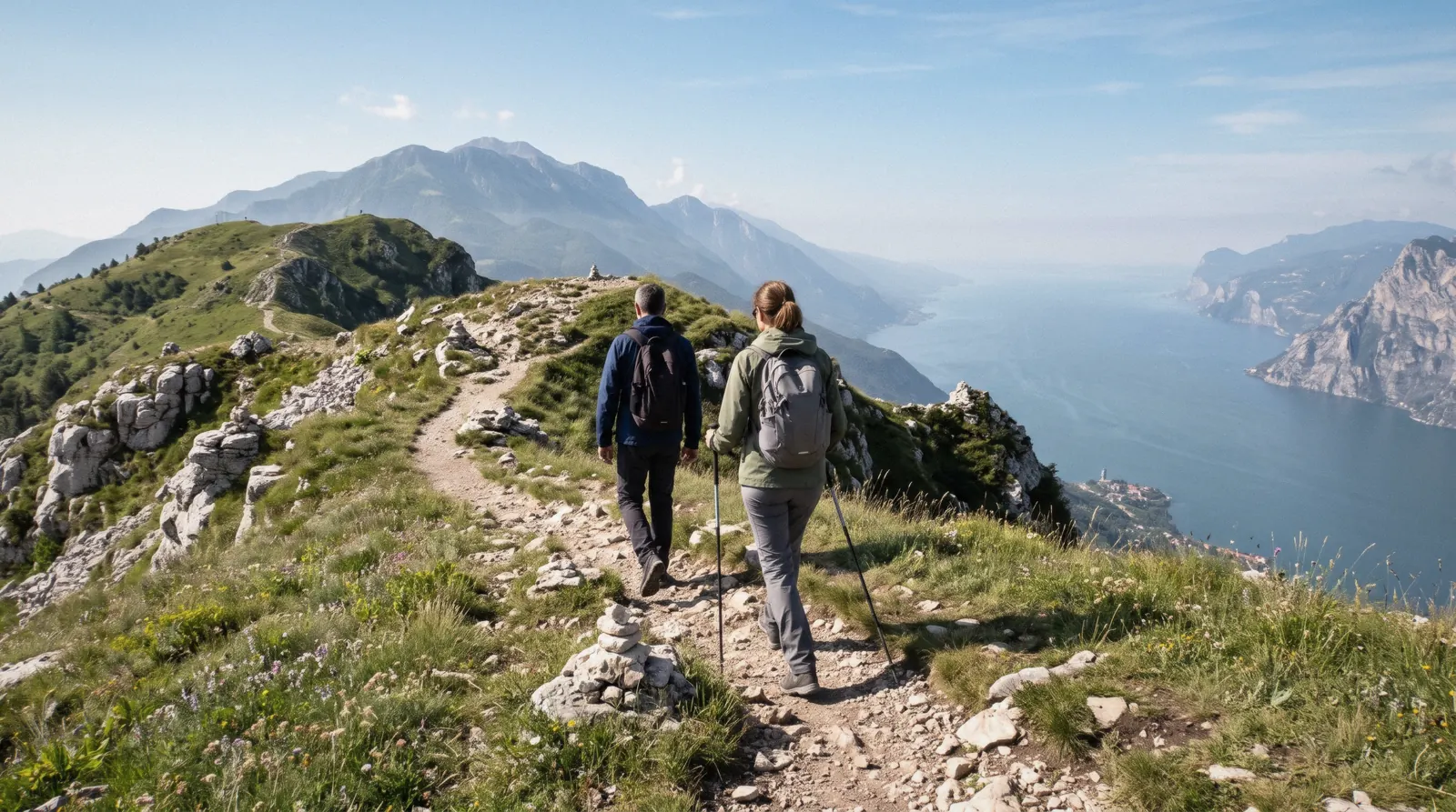
Monte Baldo: the Ridge Above Lake Garda, the Cable Car and the Walks From the Top
Monte Baldo is the mountain range that runs about 40 km along the east shore of Lake Garda (see Lake Garda attractions), from the valley between Rovereto and Nago-Torbole in the north to the plain at Caprino Veronese in the south. Its highest point, Cima Valdritta, reaches 2,218 m. The cable car from Malcesine lifts you to 1,760 m in about 20 minutes, and six marked walks start at the top. This guide covers the ridge, the way up, the walks, the flowers and what runs in each season. Fares in full are on Monte Baldo cable car tickets, and the rest of the shore is on things to do in Lake Garda.
Quick answer Monte Baldo in short
Monte Baldo is the 40 km ridge above Malcesine, highest point 2,218 m, cable car to 1,760 m in about 20 minutes. The lift runs 4 April to 1 November and closes for maintenance 2 November to 25 December. Hikes start at the top station, not at the summit.
Key takeaways
- Fares, times and online discounts live on Monte Baldo cable car tickets.
- Pick a walk from the six routes in the hike table, and check the day's last ride at the station before you set off.
- The Madonna della Corona church on the Monte Baldo side is reached on the Madonna della Corona day tour from Verona, not by the cable car.
- Pair the mountain with the old town in Malcesine.
Key facts
Opening hours
| Cable car, 4 April-1 November | 08:15–check the day's last ride |
|---|
Closed Cable car closed for maintenance 2 November to 25 December. Winter season 26 December to 21 February
Admission
- Adult
- Cable car return $33.52 (€30) at the desk, $31.28 (€28) online
- Reduced
- Junior (born 2012 or later) return $20.11 (€18), $17.88 (€16) online
- Free
- Children up to 1.20 m, with a free ticket from the desk
Planning it
- Time needed
- About 20 minutes each way on the cable car. Walks from the top station run 1 hour 15 minutes to 4 hours each way
- Book ahead
- Optional — walk-up usually fine
- Address
- Funivia Malcesine-Monte Baldo, Via Navene Vecchia 12, 37018 Malcesine (VR), Italy
Monte Baldo Cable Car Fares
The operator, Funivie del Baldo, sells every ticket at the Malcesine station and on its own website. These are the four fares most visitors need, from its fares page. Every other fare is on the Monte Baldo cable car tickets page.
Nobody resells this cable car, so the choice is desk or online: online saves €2 a ticket, the desk keeps the €3 discounts and avoids a non-refundable booking on a windy day.
| Fare | Who | Desk | Online | Book |
|---|---|---|---|---|
| Adult return, Malcesine-Monte BaldoMost adults riding to the top and back. | Born up to 2011 | $33.52 (€30) | $31.28 (€28) | Official site |
| Adult one way, Malcesine-Monte BaldoHikers who walk down or leave by the Prada-Costabella lifts. | Born up to 2011 | $24.58 (€22) | $22.34 (€20) | Official site |
| Adult return, Malcesine-San MicheleOnly the first section, to the intermediate station at about 562 m. | Born up to 2011 | $13.41 (€12) | $11.17 (€10) | Official site |
| Junior return, Malcesine-Monte BaldoChildren over 1.20 m tall. Under 1.20 m ride free with a ticket from the desk. | Born 2012 or later | $20.11 (€18) | $17.88 (€16) | Official site |
Source: Funivie del Baldo, timetables and fares. Figures current in Q4 2026.
Monte Baldo Days You Can Book
No tour includes the Malcesine cable car. The Madonna della Corona day reaches the sanctuary on the Monte Baldo side by minivan from Verona, with lunch on the mountain. The sailboat leaves Malcesine harbour, a few minutes below the valley station.
 from $148
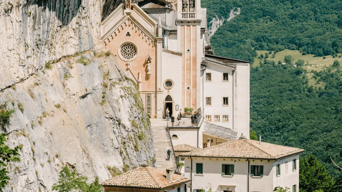
From Verona: Day tour to Madonna della Corona
A 5 to 6 hour small-group trip for 8 people that pairs the cliff sanctuary visit with a long included lunch on Monte Baldo.
Check Availability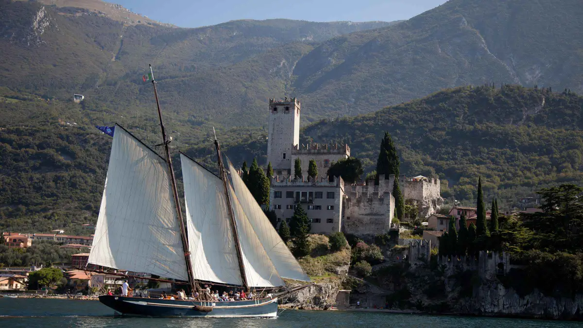 from $45
Malcesine: Panoramic Cruise on Historical Sailboat
A 2-hour sailing cruise on a historic Lake Garda sailboat from Malcesine, with views of the La Forra waterfalls near Tremosine.
Check Availability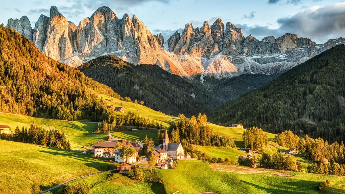 from $95
Dolomites Full-Day Tour from Lake Garda
A long 10-12 hour coach day from Lake Garda to Pordoi Pass and Ortisei with an optional €28 cable car, from $95 per person.
Check AvailabilityPrices, ratings and details are the platform's own. Dollar figures are the listed prices. The platform bills in your account's currency.
What Monte Baldo Is: a 40 km Ridge Between the Lake and the Adige
Monte Baldo is a whole range, not one peak, and the cable car stops well below its summits.
Peaks and the Shape of the Ridge
The range runs about 40 km beside the lake. To the north a valley joins Rovereto to Nago-Torbole, to the east lies the Vallagarina along the Adige, to the south the mountain fades into the plain at Caprino Veronese, and to the west Lake Garda follows it the whole way. It spreads over the provinces of Trento and Verona and nine municipalities, Malcesine among them.
Its highest point is Cima Valdritta at 2,218 m. For a day visitor the key fact is that the cable car stops at Tratto Spino, 1,760 m, so every summit is reached on foot. The nearest, Cima Pozzette, is a 3-hour walk out and back.
The figures differ by a few metres between sources, as the table shows.
The main peaks of the range, with the heights the cable car operator gives on its Monte Baldo page. Cima Valdritta and Cima Telegrafo are the ones the operator's longest walk reaches, Cima Pozzette the closest summit to the top station.
| Peak | Height |
|---|---|
| Cima Valdritta | 2,218 m |
| Punta Telegrafo | 2,200 m |
| Cima del Longino | 2,180 m |
| Cima delle Pozzette | 2,128 m (2,125 m on the walk page) |
| Cima delle Buse | 2,154 m |
| Monte Altissimo | 2,078 m |
The Name and the Garden of Europe
The name comes from the German word Wald, forest, and appears for the first time on a German map in 1163, according to Wikipedia. The mountain's other name, the Garden of Europe, comes from its range of habitats. The lake moderates the climate, so Mediterranean scrub and olive groves at the bottom give way to beech and pine forest, then to alpine meadow and rock near the top, and more than 60 types of orchid bloom between March and August.
The Sentiero della Pace, the Peace Trail, one of the long-distance paths of northern Italy, crosses the range. The plants and animals are in the nature section.
Border Country at Bocca dei Forti
The ridge was once a frontier. Until 1915 the Guardia di Finanza used the barracks at Tratto Spino, at a spot called Bocca dei Forti, to guard the border between Italy and Austria, which ran a short distance away. Smugglers worked the area, which is why the post sat there.
You pass the former barracks on two of the operator's walks, the Malcesine Peak loop and the malga tour, on the way back to the cable car. The castle in the town below tells the same story from a different century: the Austrians who held Malcesine from 1798 to 1866 turned it into a garrison. See Malcesine castle.
Source: Funivie del Baldo, Funivie del Baldo hikes, Wikipedia.
Is Monte Baldo Worth It?
For most first-time visitors to the east shore, yes, on a clear day in the cable car season.
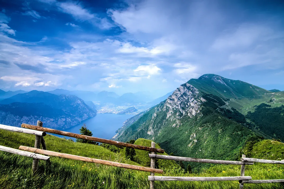
The view north from Monte Baldo towards Riva del Garda. Photo: Timo Rüßler, CC BY-SA 3.0, via Wikimedia Commons
Who It Is Worth It For
Anyone who wants the big view over Lake Garda. From the summit cross of Cima Pozzette, a 3-hour walk out and back from the top station, the operator says you see a large part of the lake from Riva to Sirmione, plus the Brenta Dolomites and the Lessini. The ride is part of it: about 20 minutes, the upper cabin rotating 360 degrees on the way up.
Walkers get six marked routes from easy to expert, and paragliders launch about 1 km from the top station all year. If you are based in Malcesine, the valley station is in town, so a morning on the mountain leaves the afternoon for the castle or the water. For a base on this shore, see where to stay.
When It Is Not
Skip it from 2 November to 25 December, when the cable car is closed for maintenance and there is no way up from Malcesine. Wind, faults or a power cut can stop the lift, and the ticket is valid for one day only with no refund for bad weather or a partial shutdown. An online booking slot does not guarantee a departure at that time either.
So on a day of strong wind or low cloud, keep the money and look at the lake from the shore instead. The weather at 1,760 m also changes fast, and the operator asks walkers to carry proper clothing, hiking shoes, a hat, water and snacks.
Source: Funivie del Baldo, tickets terms, paragliding.
How to Get Up Monte Baldo
Most people ride the cable car from Malcesine. A chairlift climbs the Trentino side in summer, and roads reach the high pastures but not the summits.
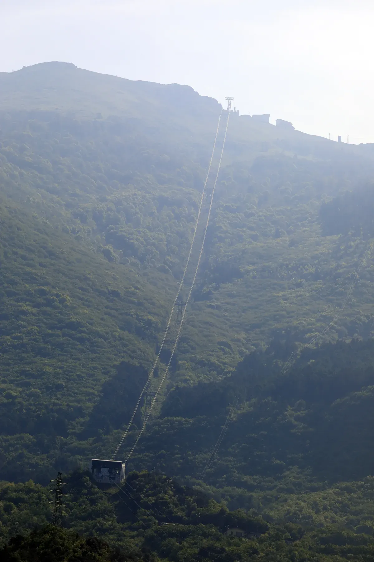
The cable car line climbing from Malcesine towards the ridge. Photo: Falk2, CC BY-SA 4.0, via Wikimedia Commons
The Cable Car From Malcesine
The cable car climbs in two sections. Cabins for up to 42 people run from the valley station at Via Navene Vecchia 12 to San Michele, at about 562 m. There you change to the rotating cabin, up to 75 passengers, which turns 360 degrees on its way to Tratto Spino at 1,760 m.
The whole ride takes about 20 minutes. Wikipedia gives the lower section as 1,512 m long with 463 m of climb, and the upper as 2,813 m long with 1,187 m of climb. The adult return is $33.52 (€30) at the desk or $31.28 (€28) online.
The first ascent is 8:15 and departures run at least every 30 minutes from 8:30. Every other fare and the discounts are on Monte Baldo cable car tickets.
The Prà Alpesina Chairlift
On the Trentino side, in the municipality of Avio, the four-seat Prà Alpesina chairlift climbs from 1,450 m to 1,890 m on a 1,500 m line in about 10 minutes, to a viewpoint on the ridge called the Belvedere. Its base is on the provincial road about 15 km from Avio, with parking next to it and the Chalet Falco restaurant, owned by the cable car company. It runs mid-June to mid-September.
An adult return is $11.17 (€10), one way $7.82 (€7). From the top you can walk to Tratto Spino in about 30 minutes on a dirt road or 20 minutes over the rocks of the ridge. Check before you drive there: the operator's page shows the chairlift temporarily closed for scheduled maintenance.
Can You Drive to the Top?
Not to the summits. The highest peaks are reached only on foot. Cars do reach the high ground in places: there is parking at the San Michele intermediate station, so you can drive part of the way and ride only the upper section, and the Prà Alpesina chairlift base on the Trentino side is on the provincial road about 15 km from Avio.
The malga tour from the top station also meets a paved road at Bocca di Navene. The cable car operator notes that the Baldo provincial road number 3 opens in summer and is closed in winter. For the ridge walks themselves, the cable car from Malcesine is the direct way, and it puts you at 1,760 m in about 20 minutes.
By Bus to the Valley Station
The cable car operator lists two bus lines for Malcesine: line 483 runs Peschiera, Garda and Malcesine, and line 484 runs Garda, Malcesine and Riva del Garda, so the mountain is reachable from the south and the north of the lake without a car. Malcesine has no railway. The nearest stations are Rovereto from the north and Verona or Peschiera del Garda from the south.
Drivers on the A22 motorway leave at Affi coming from Verona or at Rovereto Sud coming from Trento. The valley station has an underground car park with 170 spaces, and Malcesine castle is about 5 minutes away on foot.
Source: Funivie del Baldo, the cable car, Funivie del Baldo, timetables and fares, Funivie del Baldo, Prà Alpesina chairlift, Funivie del Baldo, how to get there, Wikipedia, Funivia Malcesine-Monte Baldo.
Monte Baldo Hikes From the Top Station
Six marked routes start from the cable car top station at Tratto Spino or from the Prà Alpesina chairlift. The lengths, times and grades are the cable car operator's.
Every walk here has one hard rule: be back at the top station before the last ride down. The two official pages give different last-ride times, so check the day's timetable at the station when you arrive. The table compares the six routes the cable car operator describes, with its own length, time, climb and grade.
Times are for the whole walk unless marked each way.
| Route | Length | Time | Climb | Level |
|---|---|---|---|---|
| Malcesine Peak loop | 3.6 km | 2 h | 260 m | Easy |
| Ventrar trail | 5 km | 2 h | 500 m | Challenging |
| Cima Pozzette | 7 km | 3 h | 400 m | Intermediate |
| Malga tour loop | 7.5 km | 3 h | 450 m | Intermediate |
| Cima Valdritta and Cima Telegrafo | 9 km each way | 4 h each way | 800 m up, 400 m down | Challenging |
| Prà Alpesina nature trail | 3.6 km | 1 h 15 | 422 m downhill | Easy |
Malcesine Peak Loop
The easiest walk on the mountain, 3.6 km and about 2 hours with 260 m of climb. Leave the cable car, bear left and left again at the wooden ski-rental hut, and a short climb brings you to the first viewpoint, looking south over most of the lake. Past the poles of the Paperino ski-school lift you follow the crest, with the Lessini mountains, the Brenta Dolomites and the Lagorai in view, to a wooden fence with a bench and the view north over the top of the lake.
From there a steep path drops to a dirt road that brings you back past Malga Zocchi di Sopra and the former Tratto Spino barracks. The steep descent is the one stretch to take slowly in wet weather.
The Ventrar Trail
The Ventrar trail is 5 km and about 2 hours, but it gains 500 m and the operator rates it challenging. It starts along the Malcesine Peak on trail 651, drops steeply to a dirt road, then enters the forest on a narrow path under high rock faces, with exposed stretches secured by a metal rope. The Italian Alpine Club grades it EE, for expert hikers, and the operator says plainly that it is not for anyone who suffers from vertigo.
If that is you, take the Malcesine Peak loop instead. Past the hard part the path turns the mountain and opens onto the lake, and trail 16 leads back uphill to the cable car by the Paperino ski lift. Wear proper hiking shoes, not trainers.
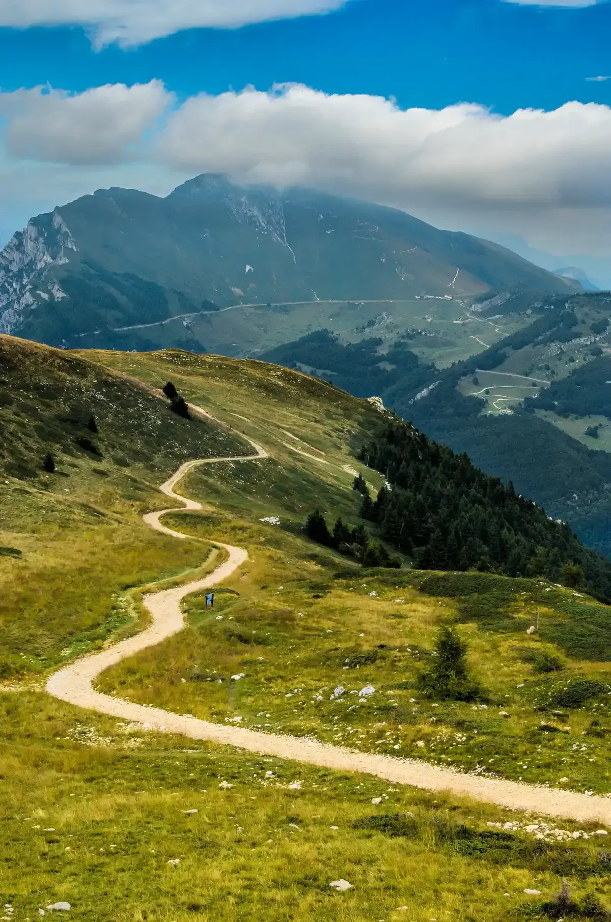
A track across the high meadows of the Monte Baldo massif. Photo: Timo Rüßler, CC BY-SA 3.0, via Wikimedia Commons
Cima Pozzette
Cima Pozzette is the day visitor's summit. From the top station turn right onto trail 651, pass the Baita dei Forti inn and walk a nearly level stretch before the climb up the ridge between stones and small rocks. You pass the top of the Prà Alpesina chairlift and a line of stone cairns, then the Lastoni Selva Pezzi nature reserve, and the steepest section comes near the end.
The operator gives about 1 hour 30 minutes to the cross at 2,125 m, and 7 km, 3 hours and 400 m of climb for the whole walk out and back. From the summit cross you see a large part of the lake from Riva to Sirmione. The return is by the same path, which makes it easy to turn back early if the weather changes.
The Malga Tour
A malga is an alpine dairy hut, and this 7.5 km loop of about 3 hours and 450 m of climb links several of them. Turn left out of the cable car onto dirt trail 651, past the former barracks, down to Malga Zocchi di Sopra at 1,650 m, where the operator says you can taste cheese and other food made at the malga and see the animals. Trail 651m then runs through the woods to Bocca di Navene and its view of the lake, and the signs for the malghe and flowers trek lead past Malga Zocchi di Sotto and Malga Tratto Spino di Sotto at 1,440 m.
Trail 14 climbs back through the forest to the cable car. Part of it follows the Prà Alpesina nature trail, with signs about the plants, animals and traditions of the mountain.
To Cima Valdritta and Cima Telegrafo
This is the full ridge walk, 9 km and about 4 hours each way, 800 m of climb and 400 m of descent, rated challenging and meant for experienced hikers. Trail 651 heads south past the Baita dei Forti to Cima Pozzette, then on to Cima del Longino, onto the eastern slope and a short equipped section near Cima Valdritta. A 15-minute detour off trail 651 reaches the highest point of Monte Baldo at 2,218 m.
Another hour beyond the Forcella Valdritta brings you to Cima Telegrafo at 2,200 m, with a mountain hut just below it. By our sum that is about 8 hours on foot before the ride down, so take the first ascent at 8:15 and check the day's last descent before you set off.
The Prà Alpesina Nature Trail
The gentlest named route, 3.6 km and about 1 hour 15 minutes, all of it downhill, 422 m, rated easy. It starts from the Prà Alpesina chairlift car park by the Chalet Falco on the Trentino side: ride to the top station, then follow the ridge on trail 651 towards the Malcesine cable car, with the south of the lake behind you and the Brenta Dolomites ahead. At the Bocca Tratto Spino plain you turn right into pasture and woods, steeper near the end, down to Malga Tratto Spino di Sotto and Malga Prà Alpesina, and back to the car park.
Signs along the way explain the flora, fauna and traditions of the mountain. It depends on the chairlift, which runs mid-June to mid-September and shows a maintenance closure on its page, so confirm it is running first.
Source: Funivie del Baldo hikes, Prà Alpesina chairlift, safety advice.
Why Monte Baldo Is Called the Garden of Europe
The lake shapes the mountain's climate, so the slopes run from olive groves to alpine rock in one climb.
The Flora
The cable car operator explains the name by the habitats stacked on one mountain: Mediterranean scrub and silver olive groves around Malcesine, then dense beech and pine forest, then meadows and rock on the high peaks. More than 60 types of orchid bloom on the slopes from March to August, at different times by altitude. The species the operator singles out are edelweiss, the red lily, the Monte Baldo anemone and the wild peony, along with arnica and buttercups in the hay meadows, flowers that it says also flavour the milk of the grazing herds.
For flowers, spring and early summer are the months to come. Stay on the marked paths: the operator's rules ask walkers to respect the plants and not to stray.
The Fauna
Birds on the list include the golden eagle, the kite, the tawny owl and the eagle owl, the woodpecker and the hoopoe. Among the mammals are the badger, rarely seen because it moves at night, the fox, the weasel and the beech marten, roe deer, the chamois on the highest rocks and the marmot, which the operator calls almost a symbol of Monte Baldo. The operator's rules exist for them: do not pester the animals, do not roll stones, and keep dogs on a leash so they do not scatter the grazing herds.
For more walking around the lake, see Lake Garda hiking.
Source: Funivie del Baldo, operator FAQ.
Paragliding, Mountain Biking and Winter on Monte Baldo
The mountain works all year: flown in every season, ridden by bikers in summer, skied on natural snow in winter.
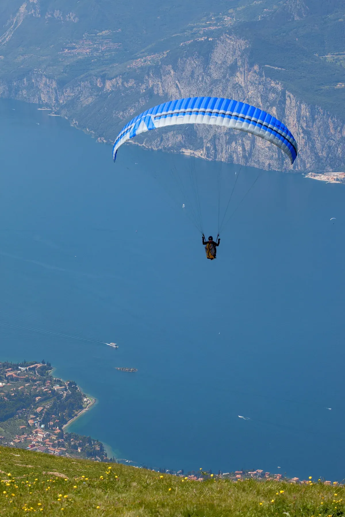
A paraglider out over the lake from Monte Baldo. Photo: Rafał Klisowski, CC BY-SA 3.0, via Wikimedia Commons
Paragliding From Monte Baldo
The take-off area lies about 1 km from the cable car top station, laid out for solo and tandem flights, and the landing field is outside the centre of Malcesine to the north, run by the Paragliding Club Malcesine, with a raft rescue service in summer. A flight lasts about half an hour over a height difference of about 1,700 m, and the operator says you can fly all year, winter included. A pilot with a paraglider pays $23.46 (€21) for the ride up, $21.23 (€19) online, or a reduced $14.52 (€13), $12.29 (€11) online, from 8:15 to 9:30 and from 15:30 to 18:00 (16:00 from 5 October).
Online paragliding tickets are one way up only, valid for the slot bought, and not refunded for weather.
Mountain Bikes on the Cable Car
Bikes go up on set departures: 8:25, 8:55, 14:15 and 15:15, plus 16:15 and 17:15 until 4 October. There are 24 bike places an hour and the operator recommends booking ahead. A rider with a bike pays $33.52 (€30) for the ride up, $31.28 (€28) online, and the online ticket is one way up only.
The operator also reminds riders that mountain bikes are not allowed in meadows, pastures, forests, ski slopes or on footpaths, and that the bike routes are kept by third parties. For more riding around the lake, see Lake Garda cycling.
Skiing and Snowshoes
In winter the mountain runs a small ski area of about 10 km of slopes with a chairlift and ski lifts. There is no artificial snow, for lack of water at altitude, so everything depends on natural snowfall, and the operator updates the state of the slopes each morning. The cable car's winter season runs 26 December to 21 February, after the maintenance closure of 2 November to 25 December.
Snowshoes can be rented at the Baita dei Forti near the top station, and the operator suggests snowshoe walks for families. For the rest of the lake in the cold months, see Lake Garda in winter.
Source: Funivie del Baldo timetables and fares, paragliding, winter.
Where to Eat at the Top
Food at the top comes from the bar in the cable car station and a few mountain restaurants close by.
Restaurants on the Mountain
The highest food is inside the top station: the SkyWalk Monte Baldo Lounge Bar, with a panoramic terrace, serves breakfast, hot meals, focaccia, sandwiches and salads, and cakes such as tiramisu, Sacher and apple strudel. A short walk away are two family-run restaurants, the Baita dei Forti, which also has rooms and rents snowshoes in winter, and La Capannina. The Baita dei Forti sits on trail 651, so walkers heading for Cima Pozzette pass it.
Near the San Michele intermediate station, the Locanda Monte Baldo opened for the season on 22 April and closes on Tuesdays. On the Trentino side, the Chalet Falco by the Prà Alpesina chairlift is owned by the cable car company and has a playground beside it. No prices are published for any of them.
For eating down by the lake, see where to eat on Lake Garda.
Source: Funivie del Baldo, where to eat, Funivie del Baldo, SkyWalk.
Monte Baldo and Its Cable Car in Dated Lines
The mountain has been mapped for centuries and crossed by borders. The lift itself is younger than most of the towns it serves.
-
1163
The name appears on a map
Monte Baldo first shows up on a German map in 1163. The name derives from the German word Wald, meaning forest.
-
until 1915
A border post at Bocca dei Forti
The Tratto Spino barracks were used by the Guardia di Finanza to watch the Italy-Austria border, which ran a short distance away. The area saw smuggling.
-
1955
The cable car company is founded
The operator was set up by the Province and Chamber of Commerce of Verona together with the Municipality of Malcesine.
-
30 September 1962
The first cable car opens
The inaugural ride took place before Head of State Antonio Segni. Between 1962 and 2001 the old lift carried over 6 million passengers.
-
1962-2001
Six million passengers
In its first four decades the original cable car carried over 6 million passengers, before the operator commissioned a new design with the University of Trento's engineering faculty.
-
24 July 2002
The new cable car is inaugurated
President Carlo Azeglio Ciampi attended the opening of the new cable car, whose upper cabins rotate a full 360 degrees.
Source: Funivie del Baldo (history and walks pages) and Wikipedia (Monte Baldo).
Do This, Not That on Monte Baldo
The mountain punishes small planning mistakes. These points come straight from the operator's own advice and ticket terms.
Do
- Bring proper clothing, hiking shoes, a hat, water and snacks, because the weather changes suddenly at altitude.
- Check the day's timetable at the station before starting any walk, since every hike has to end before your last ride down.
- Buy online for $31.28 (€28) only if you will ride whatever the weather. At the desk an ATV bus pass or a Garda promotion card brings the adult return to $30.16 (€27), and you keep the choice until the morning.
- Keep your dog on a leash and muzzled on the cable car, where a dog ticket costs $11.17 (€10) return.
- Collect the compulsory free ticket at the station office for any child up to 1.20 m, since online purchase alone is not enough.
Don't
- Do not expect a refund if wind or a technical fault stops the lift, because tickets are not refundable and bad weather is not covered.
- Do not plan the Ventrar trail if you suffer from vertigo, since it has exposed cable-secured sections.
- Do not plan to drive to the summit, because no road reaches the top.
- Do not leave the car in the underground car park past closing time, because cars cannot be collected until the next morning.
- Do not move trail signs, roll stones or pester animals, all of which the operator explicitly asks visitors not to do.
Five Things Most Visitors Do Not Know About Monte Baldo
A few details that change how you plan the day.
Five details that change how people plan the day on the mountain, each with the source it comes from.
- The cable car stops at Tratto Spino, 1,760 m. The highest point, Cima Valdritta at 2,218 m, is 9 km and about 4 hours each way on foot (Funivie del Baldo).
- The name is German: Monte Baldo comes from Wald, forest, and first appears on a German map in 1163 (Wikipedia).
- Until 1915 the Guardia di Finanza guarded the Italy-Austria border from the barracks at Bocca dei Forti, a short walk from today's top station (Funivie del Baldo).
- Children up to 1.20 m ride free, but they still need a ticket from the station desk, because it serves as their insurance on the ride (Funivie del Baldo).
- The ski area has no artificial snow, for lack of water at altitude, so winter skiing depends on natural snowfall alone (Funivie del Baldo).
Monte Baldo Map: Stations, Summits and Trailheads
The cable car valley station, San Michele, the Tratto Spino top station, Cima delle Pozzette and Cima Valdritta, plus the Madonna della Corona sanctuary on the south-east side.
Next Stop From Monte Baldo
All four are within a short walk, ride or drive of the cable car.
Malcesine
The town at the foot of the mountain, with the cable car valley station at Via Navene Vecchia 12 and the ferry harbour on the Desenzano-Riva line.
Malcesine Castle
A Scaliger castle about 5 minutes on foot from the cable car valley station, with a 31 m tower rising about 70 m above the lake. It houses a natural history museum and a room dedicated to Goethe.
Monte Baldo Cable Car Tickets
The full fare ladder, online booking discounts and the ticket terms, including the rule that tickets are valid one day only and are not refundable.
Garda Town
South along the Veneto shore, on bus line 484, which runs Garda, Malcesine and Riva del Garda, and line 483 from Peschiera. A base on the wider south lake with a bus to the cable car valley station.
Monte Baldo Questions
Is Monte Baldo worth it?
Yes, on a clear day in the cable car season. The cable car lifts you to 1,760 m in about 20 minutes, and walks from the top station look over a large part of the lake. The caveats: the lift closes for maintenance from 2 November to 25 December, wind can stop it, and tickets are not refundable. Read Monte Baldo cable car tickets before you buy.
How long is the Monte Baldo cable car ride?
About 20 minutes from Malcesine to the top station at Tratto Spino, in two stages: first to the intermediate station at San Michele, then up in the rotating cabin that turns 360 degrees. Departures run at least every 30 minutes from 8:30, with an extra first ascent at 8:15, and more often when it is busy. The valley station is in Malcesine, about 5 minutes on foot from the castle.
How much is the Monte Baldo cable car?
The adult return fare from Malcesine is $33.52 (€30) at the station, or $31.28 (€28) bought online. One-way tickets and child fares also exist. The full price ladder, booking tips and the discounts are on the Monte Baldo cable car tickets page.
Can you drive to the top of Monte Baldo?
Not to the summits, which are reached only on foot. You can drive to the San Michele intermediate station, which has parking, and to the Prà Alpesina chairlift base on the Trentino side, about 15 km from Avio. The cable car operator notes that the Baldo provincial road number 3 opens in summer and closes in winter. For the ridge walks, the cable car from Malcesine is the direct way up.
How high is Monte Baldo?
The highest point is Cima Valdritta at 2,218 m. The cable car top station at Tratto Spino sits at 1,760 m, so the summit is a walk of 9 km and about 4 hours each way. The range runs about 40 km beside the lake, and the closest summit to the cable car is Cima Pozzette. Walking the ridge is one of the main things to do in Lake Garda for hikers.
What is the Madonna della Corona church on Monte Baldo?
Madonna della Corona is a sanctuary on the Monte Baldo side of the range, above the Adige valley, and the cable car does not go there. From Verona, a small-group day for up to 8 people visits the sanctuary for about 2 hours and stops on Monte Baldo for a long lunch at a mountain osteria, 5 to 6 hours from $148. See the Madonna della Corona day from Verona.
Where Monte Baldo Fits in a Day
The mountain and Malcesine pair naturally, because the valley station and the old town are minutes apart.
The Early Ride and the Castle
Take the first ascent at 8:15, or the 8:30 departure, and walk one of the shorter loops while the morning is clear. The Malcesine Peak loop takes about 2 hours, and so does the Ventrar trail for those without vertigo. Ride down, and the valley station is about 5 minutes on foot from Malcesine castle, rebuilt by the Scaliger family around 1300, which holds the Monte Baldo and Garda Natural History Museum.
Seeing the mountain's flowers on the trail and then in the museum makes a neat pair. Bring proper clothing for the top, because the operator warns that weather changes suddenly at altitude.
The Afternoon on the Water
To balance a morning on the ridge with an afternoon on the water, the harbour of Malcesine is close to the valley station. The Siora Veronica sailing cruise, on a boat about 100 years old, sails for 2 hours on the afternoon wind towards the west shore, past the waterfalls near Tremosine and the road of the Strada della Forra, and returns past the castle walls, at $45 per person with drinks on board. No last-ride time is printed here, because the two official pages disagree: check it at the station on the day.
Other boat days are on Lake Garda tours. For the whole lake, start with what to see in Lake Garda.
Source: Funivie del Baldo, timetables and fares, Visit Malcesine, Castello Scaligero.
Monte Baldo on Film: the Ridge and Its Trails
Three walks filmed on the ridge, including the cable-secured Ventrar trail.
🇮🇹 Monte Baldo Hike 4K - Worth the Visit for Lake Garda Views?
A hike along the Monte Baldo ridge from the top station with the lake below.
Video: Cool Trip WalksWalking Sentiero del Ventrar on Monte Baldo (Malcesine, Lake Garda)
The exposed Ventrar trail from the top station, the route graded EE.
Video: Juta LanderMONTE BALDO: hiking in the Italian Alps 🏔️
A hiking day on the Monte Baldo ridge above Malcesine.
Video: Dunya 🌎Videos load from YouTube only when you press play.
Prices, hours and terms are set by the venue or operator and confirmed at checkout.
We may earn a commission if you book through one of our links, at no extra cost to you. Full affiliate disclosure